


Stevens Point - C 19 Voting District, Portage County, Wisconsin
About
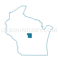
Outline

Summary
| Unique Area Identifier | 696237 |
| Name | Stevens Point - C 19 Voting District |
| County | Portage County |
| State | Wisconsin |
| Area (square miles) | 1.07 |
| Land Area (square miles) | 1.06 |
| Water Area (square miles) | 0.01 |
| % of Land Area | 99.04 |
| % of Water Area | 0.96 |
| Latitude of the Internal Point | 44.50582710 |
| Longtitude of the Internal Point | -89.58192570 |
Maps


Graphs
Select a template below for downloading or customizing gragh for Stevens Point - C 19 Voting District, Portage County, Wisconsin


Neighbors
Neighoring Voting District (by Name) Neighboring Voting District on the Map
- Stevens Point - C 17 Voting District, Portage County, WI
- Stevens Point - C 18 Voting District, Portage County, WI
- Stevens Point - C 20 Voting District, Portage County, WI
- Whiting - V 1 Voting District, Portage County, WI
- Whiting - V 4 Voting District, Portage County, WI